Tree Matrix is excited to announce the release of GIS capability. This new functionality includes built-in base maps with satellite and street view layers. Additionally, users can add GeoJSON sources by file upload into their plans. Tree inventory files, topological maps and other data can be added to your projects and easily configured to interact with tree root zones as appropriate.
GIS Tutorial Video
1
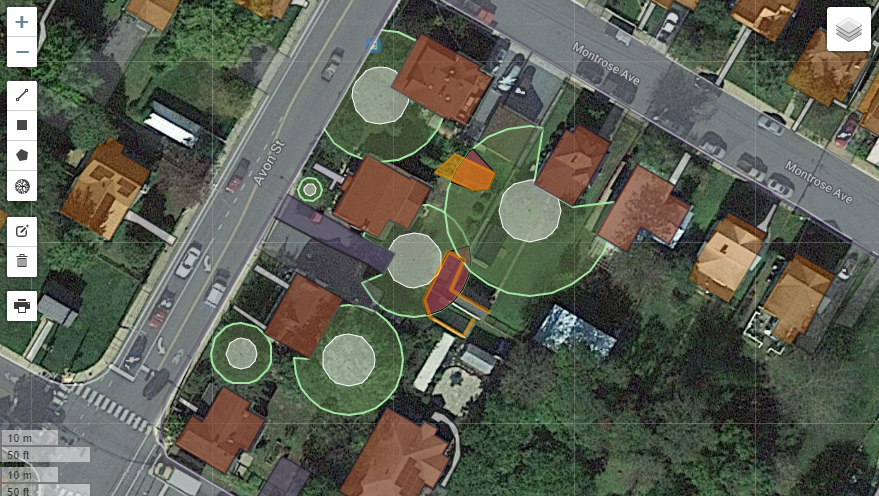
Satellite and Hybrid Map Layers
Satellite Imagery
Identify your project location and then overlay site plans, CAD drawings or manually manipulate image. Click to identify existing structures such as roads and buildings that can redirect root growth.
2
Street Map Vector View
Toggle Map View and Add Custom Layers
Switch easily between street map vector view and Google's hybrid satelite view.
3
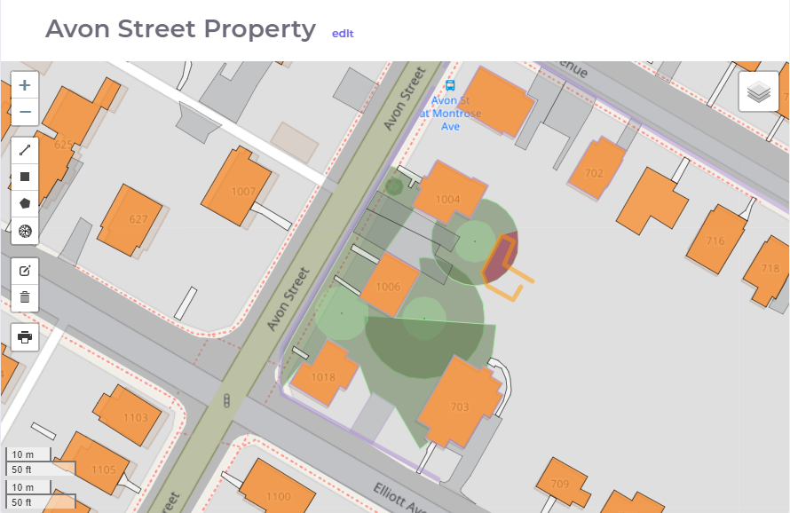
Add User Data Sources
Add Your Own Data Sources
Buildings and Structures
Roads and Driveways
Topographical Maps
Soil Maps
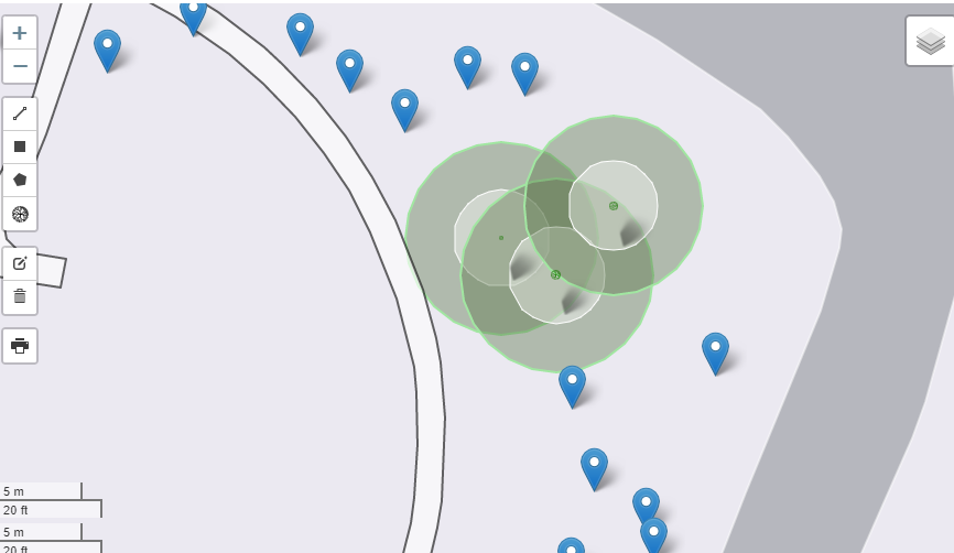
Tree Inventory Files
This example shows a tree inventory data file as it is imported in to Tree Matrix. Import or access topographical data, soil data or other important GIS features that may enhance your plan.
4
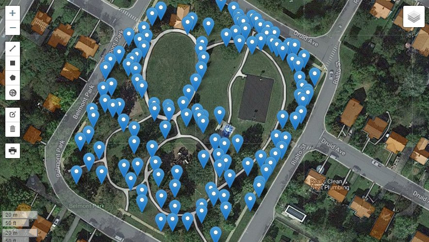
Easily Import Tree Locations
Turn a Tree Inventory File into Survival Scores
In just a few clicks you can turn a tree marker from an inventory system into an estimated Tree Matrix Root Zone which interacts with objects new and existing and predicts survival scores.
5
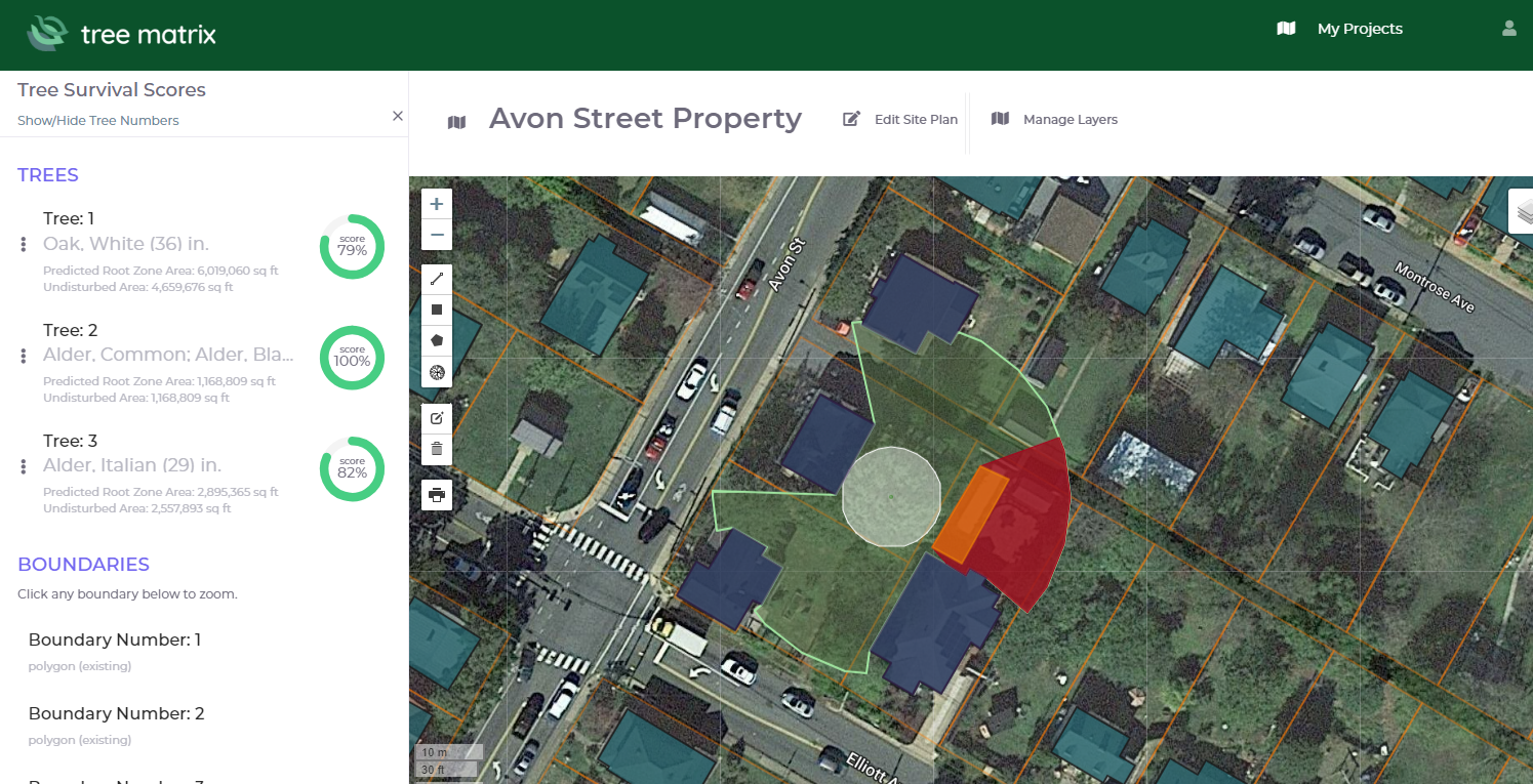
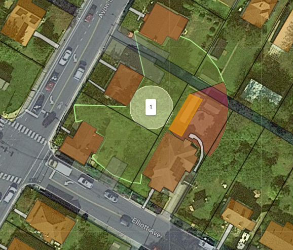
Root Systems Cross Lot Lines
Root Plotter Depicts Roots Crossing Lot Lines
this example demonstrates how root systems cross lot lines and the extent to which a pool being added to a neighbor's property can damage the root systems on adjacent properties.